Home
East Gate
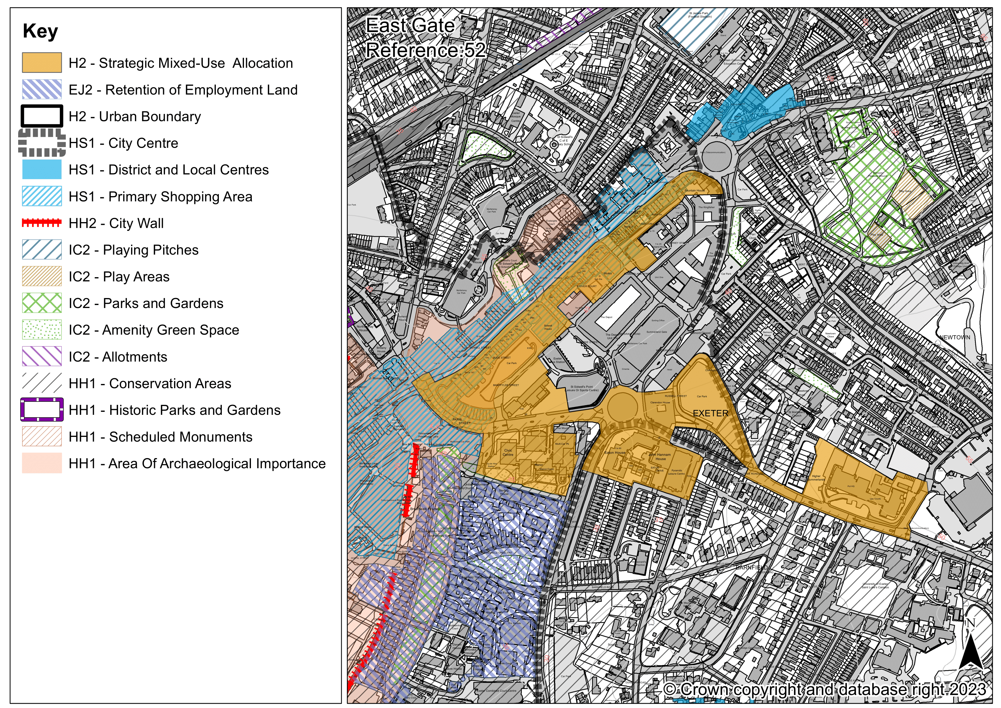
East Gate: Site reference 52
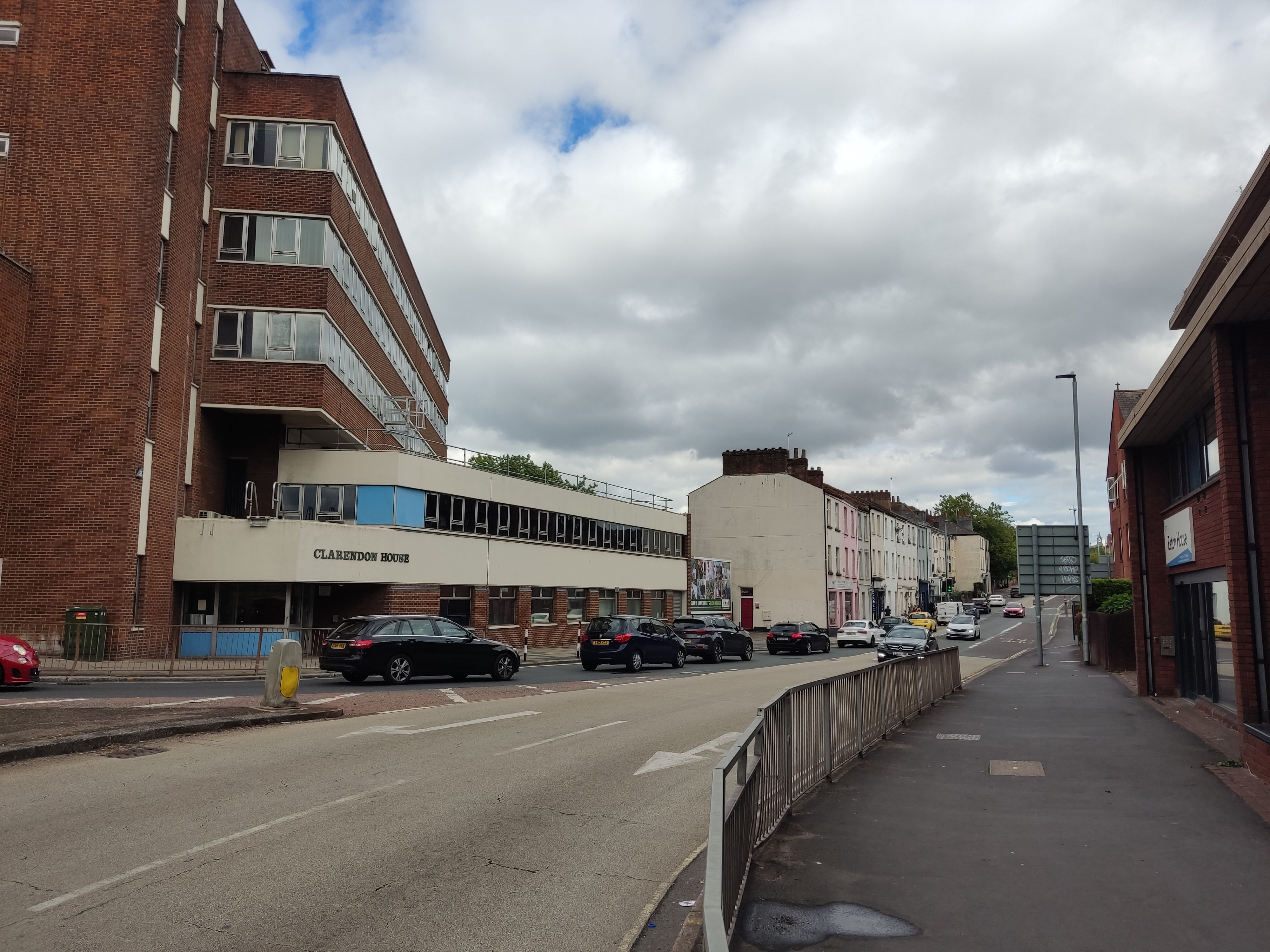
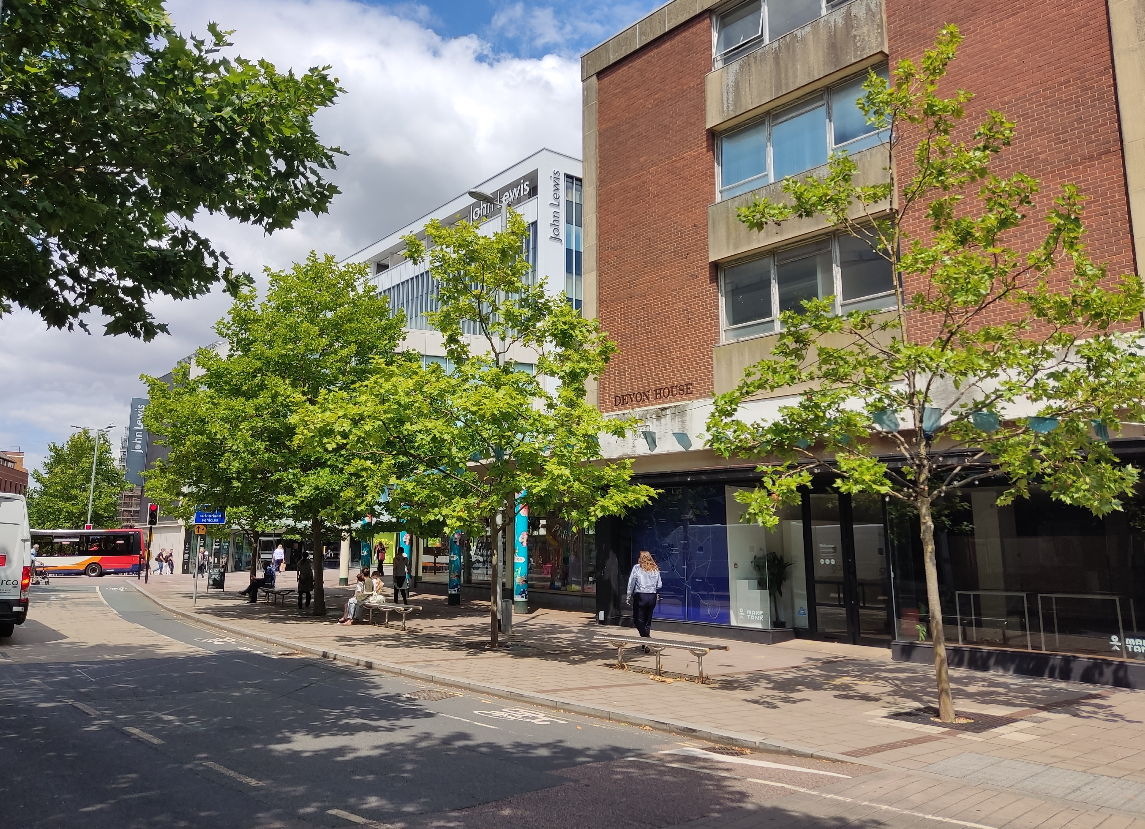
East Gate is a large strategic site proposed for allocation in the Exeter Plan. Located centrally within the city, the site is brownfield and stretches from Sidwell Street, along Paris Street down to Heavitree Road. It currently contains a variety of uses including office, business and retail, residential, public car parking, the former bus station and former Pyramids Leisure Centre.
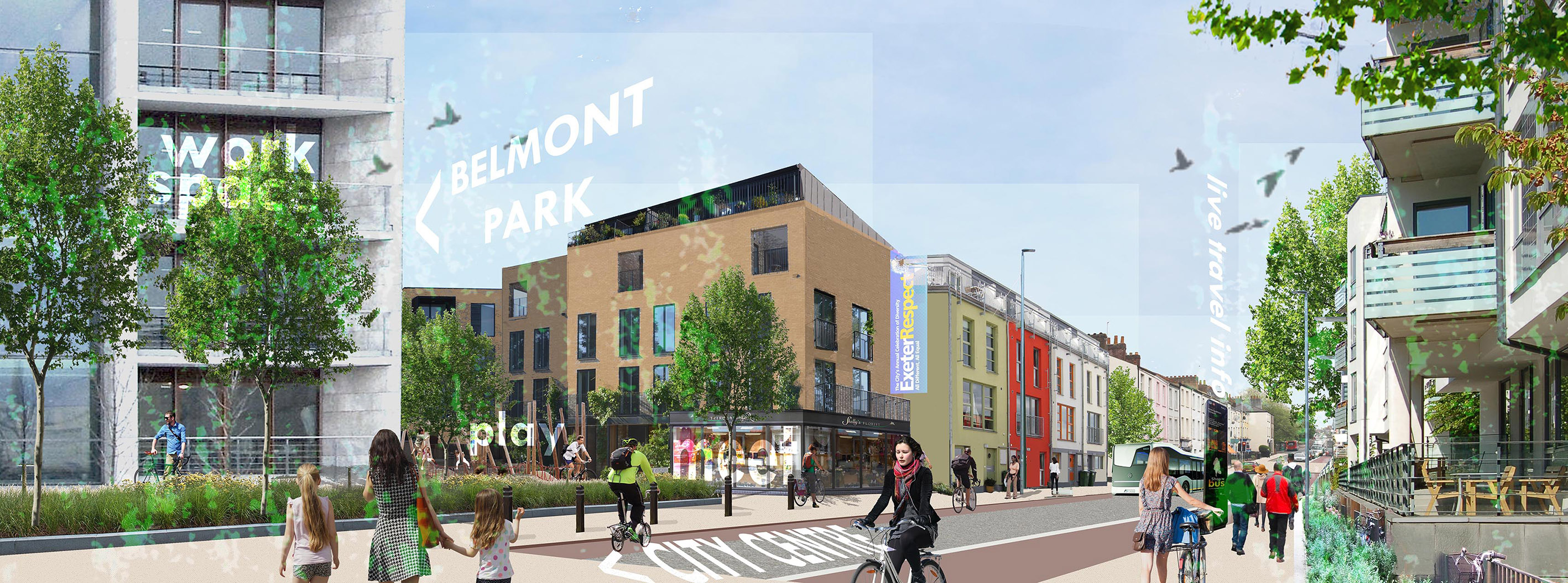
East Gate provides a great opportunity to regenerate a tired area of the city into a high quality, low or zero-car new neighbourhood that is well served by the wide range of services, employment and facilities offered by its city centre location. Development will need to respond to challenges such as viability, heritage, protecting the amenity of nearby residents and ensuring sufficient provision for facilities currently in existence on the site.
The site is currently in multiple ownerships, although large parts of the site are owned by the City Council, including along Sidwell Street and Paris Street. The area includes the large regeneration scheme known as City Point. The site boundary has changed slightly since the last Exeter Plan consultation to include some unused land adjacent St Sidwell’s Point and the Manor Court office building.
Further work will be required to consider the delivery of East Gate. Consultation with the local community will be required before the submission of planning applications.
East Gate – Reference 52 (Strategic policy)
A site of 10.5 hectares at East Gate is identified for a mixed-use development delivering approximately 850 homes, provision for employment and an impressive and memorable city centre gateway. The development must support the achievement of net zero and accord with the Liveable Exeter Principles to deliver a compact and well-connected neighbourhood, incorporating the highest standards of design.
The following will be required:
A. A housing mix built to optimal densities taking account of local context and the Exeter Density Study which meets a wide range of housing needs including:- 35% affordable homes for eligible households with a local connection or key workers, of which 50% will be for social rent, 13% for affordable rent, 25% for First Homes with a discount of 30% on market prices and the remainder for additional affordable homeownership;
- Custom and self-build plots;
- At least 10% of market homes and 10% of affordable homes built to meet wheelchair adaptable standards and all other homes built to meet accessible and adaptable standards; and
- A range of dwelling sizes that takes account of local need.
B. A mix of new forms of employment provision to meet the needs of the transformational sectors, including work hubs, collaborative workspace and live-work schemes.
C. Social, community and cultural infrastructure including:- Public realm that provides space for community and cultural activities;
- Retail or commercial units;
- A work hub;
- A mobility hub;
- An innovation and literary hub;
- Contributions to early years, primary, secondary and special educational needs provision; and
- Contributions to GP provision.
- Improved active travel routes which link to the existing routes in the area;
- Contributions to off-site active travel routes including priority schemes in the Exeter Local Cycling and Walking Infrastructure Plan;
- A mobility hub to provide for public transport, active travel and shared mobility;
- Provision of infrastructure for, and contributions to, public transport; and
- Electric vehicle charging points throughout the site.
E. Enhancement of the natural environment and Green Infrastructure :
- Green Infrastructure provision in accordance with the Green Infrastructure Strategy including contributions to off-site provision;
- Mitigation contributions to ensure no adverse effect on the European Sites, in accordance with requirements set out in the South-east Devon Mitigation Strategy; and
- Biodiversity enhancements.
F. An energy strategy that minimises carbon emissions (both operational and embodied), incorporates renewable and low carbon energy generation and helps to deliver, and connect to, local energy networks.
G. Appropriate flood risk mitigation:- A layout informed by a detailed flood risk assessment which addresses flood risk from all sources;
- Sustainable Urban Drainage to mitigate against flood risk; and
- Provision of the necessary infrastructure to help deliver the Drainage and Wastewater Management Plan.
H. Conservation and enhancement of the historic environment:
- A layout informed by archaeological and heritage assessment, evaluation and mitigation; and
- A built form that enhances the character and appearance of the Southernhay and The Friars and the Lower Summerlands Conservation Areas and protects the settings of all listed buildings including Sidwell Street Methodist Church (grade II* listed), 13-15 Dix’s Field (grade II*) and those along Heavitree Road and Dix’s Field.
Note: Policy not yet tested by viability appraisal.
You can use the slider on the images below to view an illustrative example of how the site might look in the future.

This engagement phase has finished

...